A really good question is which would be the best way to navigate 7000 kilometers through unknown countries, which might also use a different alphabet. In today’s world, where you have a million gadgets which get smaller each year and which can do more and more stuff, it doesn’t seem that difficult.
The thing is that usually I hate being guided by a GPS, especially when bike touring or when running or trekking in the mountains. I do find a GPS useful in the cities, as you really can’t carry a map for each city, and sometimes asking locals for addresses inside a city doesn’t really yield good results. After all if I would think about Bucharest where I’ve spent almost ten years if someone would ask me about an obscure street I would have no idea how to guide him.
And I really like maps, I like having a physical piece of paper on which you can have an overview of where you are coming from and where you are heading to. They are somehow reminiscent of a time when I started exploring the mountains of Romania, and when a map could tell you advance which places you’re going to see the following day. With time, and with getting to know the mountains the maps started remaining at home, as sometimes the map which construct in your head throughout the years is generally good enough.
I also think that sometimes with a GPS it’s impossible to get really lost, as you always know have some sort of coordinates and eventually an underlying map. At the same time getting lost isn’t the goal, but sometimes it’s nice to find yourself in the middle of nowhere being forced to figure out things for yourself.
At the same time I realise that there’s no perfect solution, and it’s simply a matter of choosing the advantages which you like and the disadvantages which you can live with. At least in my case it’s going to be combination between real maps, digital maps and a smartphone for getting some GPS coordinates if needed.
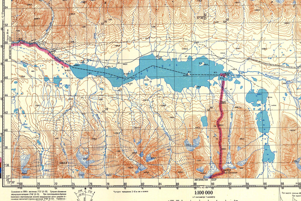
Regarding the maps, probably one of the most interesting collection of maps which I’ve found in the past months are these soviet topographic maps, which include maps in a good scale for almost half of the globe, the half in which the soviets had interests at one point or the other. The only issue is that they are in Russian, but at the same time I plan to learn a minimum of Russian before reaching the stans.
Another site with really useful information regarding the climate in different places on the globe can be found here and I’ll probably use it to get a picture of the average temperatures of the places through which I will travel through.
Last week I got two paper maps for Central Asia, one for Iran and one for the Stan’s but the scale is too large to make them really useful. But at the same time I find it is really interesting to look at these maps, and to dream that in a couple of months I will travel through all these places.

Leave a Reply